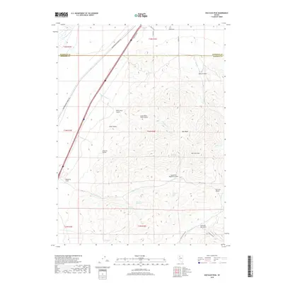
2018 Map of Dun Glen Peak
USGS Topo · Published 2018About this map
The East Range dominates this Nevada landscape, where the high point of Dun Glen Peak rises above a complex system of drainage and deep canyons. The northern end of the map is defined by the Humboldt River and the transit corridor of the Southern Pacific Company RR, illustrating the historical importance of this path for westward movement. To the south, the terrain becomes increasingly intricate as it transitions into the mineral-rich areas near Auld-Lang Syne Gulch. Numerous water sources, including Big Alkali Spring and Rasberry Spring One, suggest the vital role of specific springs in this arid environment. The naming of canyons like White Horse Canyon and Cosgrave Canyon points to a history of local exploration and land use, while the presence of Auburn Mine Rd provides a direct link to the region's long-standing mining activity.
Find a feature on this map
38 named features on this map. Tap any name to fly to it.
Don’t see what you’re looking for? This feature index may not catch every label — zoom into the map to look around manually.
Map Details
Editions of this 2018 Dun Glen Peak Map
This is the sole edition of this map. No revisions or reprints were ever made.
Other maps of this area

1931 · Lovelock
USGS Topo · 1:250,000

1932 · Sonoma Range
USGS Topo · 1:250,000

1935 · Lovelock
USGS Topo · 1:250,000

1939 · Sonoma Range
USGS Topo · 1:250,000

1939 · Eugene Mountains Area
USGS Topo · 1:62,500

1942 · Eugene Mountains Area
USGS Topo · 1:62,500

1955 · Lovelock
USGS Topo · 1:250,000

1955 · Winnemucca
USGS Topo · 1:250,000

1956 · Imlay
USGS Topo · 1:62,500

1958 · Winnemucca
USGS Topo · 1:250,000