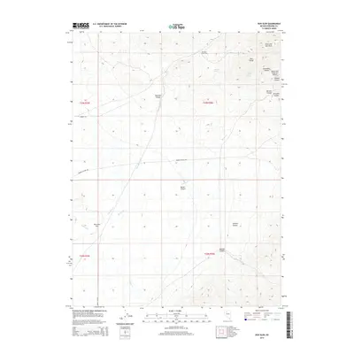
2014 Map of Dun Glen
USGS Topo · Published 2014About this map
Dun Glen (Historical) sits at the northern end of the East Range, marking a site of early settlement in the high desert of Pershing County. This 2014 survey documents the rugged landscape defined by the drainage systems of Dun Glen Cr and Barbers Cr, which flow toward the broad Dun Glen Flat. The topography is dominated by the prominent Auld Lang Syne Peak in the northeast, surrounded by a complex network of canyons including Emigrant Canyon, Jackrabbit Canyon, and Orofino Canyon. The distribution of named water sources like Butcher Spring and Potato Patch Spring illustrates the critical role of reliable water in this arid environment. The map also traces established access routes such as Barber Canyon Rd and Range Line Rd, which connect the historical settlement areas with the surrounding mining and ranching terrain.
Find a feature on this map
26 named features on this map. Tap any name to fly to it.
Don’t see what you’re looking for? This feature index may not catch every label — zoom into the map to look around manually.
Map Details
Editions of this 2014 Dun Glen Map
This is the sole edition of this map. No revisions or reprints were ever made.
Other maps of this area

1931 · Lovelock
USGS Topo · 1:250,000

1932 · Sonoma Range
USGS Topo · 1:250,000

1935 · Lovelock
USGS Topo · 1:250,000

1939 · Sonoma Range
USGS Topo · 1:250,000

1939 · Eugene Mountains Area
USGS Topo · 1:62,500

1942 · Eugene Mountains Area
USGS Topo · 1:62,500

1955 · Lovelock
USGS Topo · 1:250,000

1955 · Winnemucca
USGS Topo · 1:250,000

1956 · Imlay
USGS Topo · 1:62,500

1958 · Winnemucca
USGS Topo · 1:250,000