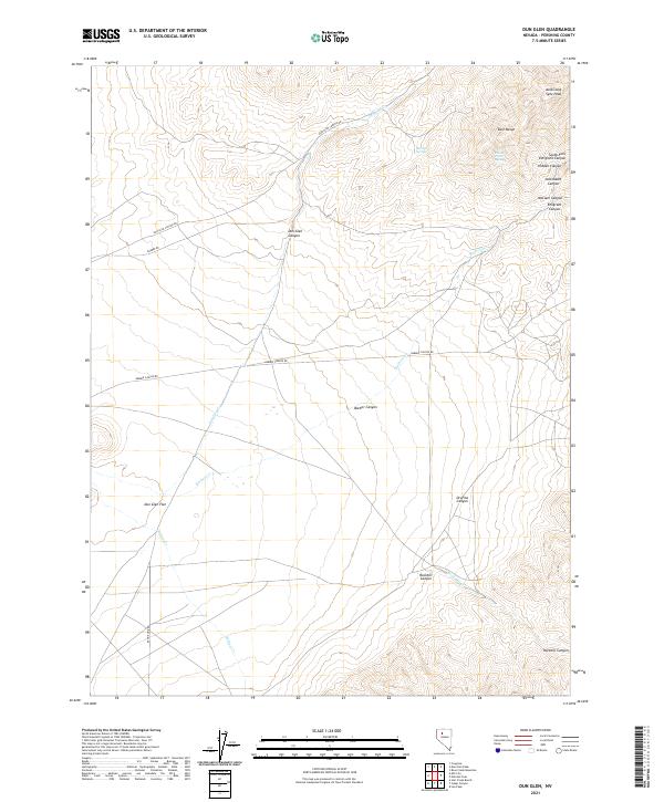
2021 Map of Dun Glen
USGS Topo · Published 2021About this map
Auld Lang Syne Peak rises over the high-desert landscape of the East Range in this portion of Pershing County. The map details a complex network of dry canyons and seasonal watercourses, including Dun Glen Canyon and the winding Barbers Cr. Named springs such as Butcher Spring and Potato Patch Spring are critical landmarks in this arid terrain, historically serving as vital stops for transit through the Great Basin. The lower elevations transition into the broad Dun Glen Flat, where Range Line RD and Barber RD provide the primary access to the scattered canyons. Researchers of Nevada mining history or ranching lore can trace the paths through Orofino Canyon and South Fork Emigrant Canyon, which suggest the historic routes used by early travelers and prospectors navigating the rugged interior of the state.
Find a feature on this map
26 named features on this map. Tap any name to fly to it.
Don’t see what you’re looking for? This feature index may not catch every label — zoom into the map to look around manually.
Map Details
Editions of this 2021 Dun Glen Map
This is the sole edition of this map. No revisions or reprints were ever made.
Other maps of this area

1931 · Lovelock
USGS Topo · 1:250,000

1932 · Sonoma Range
USGS Topo · 1:250,000

1935 · Lovelock
USGS Topo · 1:250,000

1939 · Sonoma Range
USGS Topo · 1:250,000

1939 · Eugene Mountains Area
USGS Topo · 1:62,500

1942 · Eugene Mountains Area
USGS Topo · 1:62,500

1955 · Lovelock
USGS Topo · 1:250,000

1955 · Winnemucca
USGS Topo · 1:250,000

1956 · Imlay
USGS Topo · 1:62,500

1958 · Winnemucca
USGS Topo · 1:250,000