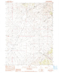
1990 Map of Dun Glen
USGS Topo · Published 1990About this map
East Range peaks and deep canyons dominate this Nevada landscape, where mining history is etched into every slope. The map marks numerous extraction points, including the Black Hole Mine and Twin Dome Mine, alongside countless prospects and mine shafts that trace the region's mineral-driven development. In the lower elevations, the expansive Dun Glen Flat meets the drainages of Dun Glen Creek and Willow Creek, providing a stark contrast to the high terrain of Auld Lang Syne Peak.
Find a feature on this map
35 named features on this map. Tap any name to fly to it.
Don’t see what you’re looking for? This feature index may not catch every label — zoom into the map to look around manually.
Map Details
Editions of this 1990 Dun Glen Map
This is the sole edition of this map. No revisions or reprints were ever made.
Other maps of this area

1931 · Lovelock
USGS Topo · 1:250,000

1932 · Sonoma Range
USGS Topo · 1:250,000

1935 · Lovelock
USGS Topo · 1:250,000

1939 · Sonoma Range
USGS Topo · 1:250,000

1939 · Eugene Mountains Area
USGS Topo · 1:62,500

1942 · Eugene Mountains Area
USGS Topo · 1:62,500

1955 · Lovelock
USGS Topo · 1:250,000

1955 · Winnemucca
USGS Topo · 1:250,000

1956 · Imlay
USGS Topo · 1:62,500

1958 · Winnemucca
USGS Topo · 1:250,000