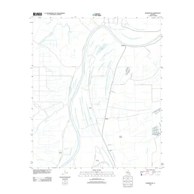
2012 Map of Dunbarton
USGS Topo · Published 2012About this map
The winding Tensas River and a complex network of bayous define this part of Concordia Parish in the early 20th century. The landscape is heavily marked by energy production, with the Ballina Oil Field, Jonesville Oil Field, and Frogmore Oil Field spread across the alluvial plains. This environment is characterized by a high concentration of water bodies such as Round Lake, Hollywood Bayou, and Big Cash Bayou, which dictate the placement of local roads. Settlement is sparse, anchored by the communities of Dunbarton and Ballina. Local history is preserved at the Eva Dale Cem, while a grid of rural routes like Haphazard Rd and Lamarque Rd provide access to the various extraction sites and dispersed homesteads. The map illustrates how industry and topography converge in a region shaped by both its natural hydrology and modern resource exploration.
Find a feature on this map
33 named features on this map. Tap any name to fly to it.
Don’t see what you’re looking for? This feature index may not catch every label — zoom into the map to look around manually.
Map Details
Editions of this 2012 Dunbarton Map
This is the sole edition of this map. No revisions or reprints were ever made.
Other maps of this area

1909 · Sycamore Landing
USGS Topo · 1:24,000

1939 · Red Gum
USGS Topo · 1:62,500

1941 · Manifest
USGS Topo · 1:62,500

1941 · Sicily Island
USGS Topo · 1:62,500

1941 · Harrisonburg
USGS Topo · 1:62,500

1953 · Natchez
USGS Topo · 1:250,000

1956 · Natchez
USGS Topo · 1:250,000

1957 · Sicily Island
USGS Topo · 1:62,500

1959 · Natchez
USGS Topo · 1:250,000

1959 · Harrisonburg
USGS Topo · 1:62,500