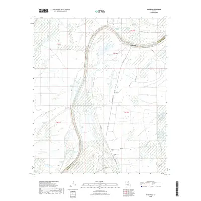
2018 Map of Dunbarton
USGS Topo · Published 2018About this map
The Tensas River meanders across this alluvial landscape, marking the boundary between Catahoula Parish and Concordia Parish. This portion of Louisiana is defined by a dense network of oxbows and backwaters, where numerous named lakes like Gin Lake, Round Lake, and Knockanar Lake suggest the shifting course of local waterways over time. The settlement of Dunbarton is situated along the river's northern reach, supported by a system of levees including the Dunbarton Levee Rd. Land use is primarily agricultural, with the terrain partitioned by drainage features such as Brushy Bayou and Pool Lake Bayou. For those researching local family history, the map identifies small, rural burial sites including Cypress Grove Cem and Eva Dale Cem. A web of parish roads, such as Vaughn Rd and Haphazard Rd, connects these isolated wetlands and farmsteads.
Find a feature on this map
58 named features on this map. Tap any name to fly to it.
Don’t see what you’re looking for? This feature index may not catch every label — zoom into the map to look around manually.
Map Details
Editions of this 2018 Dunbarton Map
This is the sole edition of this map. No revisions or reprints were ever made.
Other maps of this area

1909 · Sycamore Landing
USGS Topo · 1:24,000

1939 · Red Gum
USGS Topo · 1:62,500

1941 · Manifest
USGS Topo · 1:62,500

1941 · Sicily Island
USGS Topo · 1:62,500

1941 · Harrisonburg
USGS Topo · 1:62,500

1953 · Natchez
USGS Topo · 1:250,000

1956 · Natchez
USGS Topo · 1:250,000

1957 · Sicily Island
USGS Topo · 1:62,500

1959 · Natchez
USGS Topo · 1:250,000

1959 · Harrisonburg
USGS Topo · 1:62,500