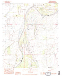
1983 Map of Dunbarton
USGS Topo · Published 1984About this map
The Tensas River meanders through this landscape on the border of Catahoula Parish and Concordia Parish, defining a territory of oxbow lakes and bottomlands. Local heritage is deeply rooted in the plantation era, with historic sites like Haphazard Plantation and Ballina Plantation still noted on the landscape. The small settlement of Dunbarton serves as a local hub, surrounded by a high density of country churches such as New St John Ch and Mt Oliva Ch, which signify the communal foundations of the rural population during the late 1970s and early 1980s.
Find a feature on this map
47 named features on this map. Tap any name to fly to it.
Don’t see what you’re looking for? This feature index may not catch every label — zoom into the map to look around manually.
Map Details
Editions of this 1983 Dunbarton Map
This is the sole edition of this map. No revisions or reprints were ever made.
Other maps of this area

1909 · Sycamore Landing
USGS Topo · 1:24,000

1939 · Red Gum
USGS Topo · 1:62,500

1941 · Manifest
USGS Topo · 1:62,500

1941 · Sicily Island
USGS Topo · 1:62,500

1941 · Harrisonburg
USGS Topo · 1:62,500

1953 · Natchez
USGS Topo · 1:250,000

1956 · Natchez
USGS Topo · 1:250,000

1957 · Sicily Island
USGS Topo · 1:62,500

1959 · Natchez
USGS Topo · 1:250,000

1959 · Harrisonburg
USGS Topo · 1:62,500