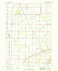
1958 Map of Dunbridge
USGS Topo · Published 1968About this map
The agrarian landscape of Wood County is defined by a grid of early roads and the persistence of small rural hubs like Dunbridge and Scotch Ridge. This mid-century survey captures a region where family-named routes such as Aufderstrasse Road and Bushdecker Road intersect with the Penn Central rail corridor. Drainage remains central to the character of the land, with Toussaint Creek, Packer Creek, and the Portage River North Branch cutting through the fields of Middleton and Webster townships. Local history is anchored by community landmarks, including the New Belleville Ridge Cem, the Township Sch, and the Webster Ch. The prominence of long-distance energy infrastructure is noted through several pipelines that traverse the township boundaries, reflecting the area's role in the broader regional industrial network during the late 1950s and 1960s.
Find a feature on this map
47 named features on this map. Tap any name to fly to it.
Don’t see what you’re looking for? This feature index may not catch every label — zoom into the map to look around manually.
Map Details
Editions of this 1958 Dunbridge Map
2 editions found
Other maps of this area

1900 · Maumee Bay
USGS Topo · 1:62,500

1900 · Toledo
USGS Topo · 1:62,500

1901 · Bowling Green
USGS Topo · 1:62,500

1901 · Elmore
USGS Topo · 1:62,500

1903 · Bowling Green
USGS Topo · 1:62,500

1903 · Elmore
USGS Topo · 1:62,500

1934 · Rossford
USGS Topo · 1:24,000

1935 · Walbridge
USGS Topo · 1:24,000

1935 · Maumee
USGS Topo · 1:24,000

1938 · Walbridge
USGS Topo · 1:31,680