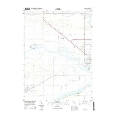
2014 Map of Duncan
USGS Topo · Published 2014About this map
The Loup River and Platte River dominate this landscape west of Columbus, where complex water management systems define the local geography. The massive Loup River Canal and Lake Babcock in the northeast contrast with the natural meandering of Barnum Cr and Lost Cr. This 2014 survey documents the western edge of Columbus and the distinct settlement of Duncan to the southwest, situated along the Union Pacific rail corridor and US Highway 30. Local history is anchored by the Jackson Cem near Duncan and the smaller communities of Sheldonville and Lakeview. The map illustrates the convergence of high-capacity transportation, including Us-81 and the Lost Creek Pky, with the industrial and agricultural heart of Platte County.
Find a feature on this map
79 named features on this map. Tap any name to fly to it.
Don’t see what you’re looking for? This feature index may not catch every label — zoom into the map to look around manually.
Map Details
Editions of this 2014 Duncan Map
This is the sole edition of this map. No revisions or reprints were ever made.
Other maps of this area

1896 · Stromsburg
USGS Topo · 1:125,000

1899 · David City
USGS Topo · 1:125,000

1955 · Fremont
USGS Topo · 1:250,000

1957 · Fremont
USGS Topo · 1:250,000

1958 · Fremont
USGS Topo · 1:250,000

1958 · Monroe
USGS Topo · 1:24,000

1958 · Duncan
USGS Topo · 1:24,000

1958 · Columbus SW
USGS Topo · 1:24,000

1958 · Silver Creek SE
USGS Topo · 1:24,000

1958 · Columbus SE
USGS Topo · 1:24,000