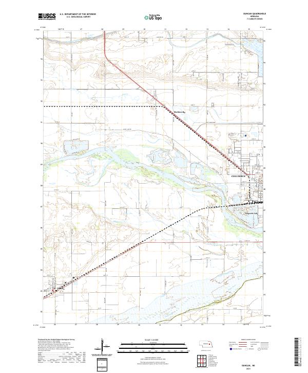
2021 Map of Duncan
USGS Topo · Published 2021About this map
Columbus and the settlement of Duncan anchor this map of the Nebraska river valleys as they appeared in 2021. The landscape is defined by the braided channels of the Platte River and the Loup River, which converge in a complex network of waterways, sandbars, and small lakes. The Loup River Canal runs along the northern edge of the map, a testament to the region's managed water resources for power and agriculture. The rural character of the area is punctuated by landmarks such as the Jackson Cem and Wagners Lake, while Sheldonville sits along the highway corridor. Small creek systems like Lost Cr and Barnum Cr thread through the township sections, illustrating the drainage patterns that have shaped local farming and settlement since the 19th century.
Find a feature on this map
52 named features on this map. Tap any name to fly to it.
Don’t see what you’re looking for? This feature index may not catch every label — zoom into the map to look around manually.
Map Details
Editions of this 2021 Duncan Map
This is the sole edition of this map. No revisions or reprints were ever made.
Other maps of this area

1896 · Stromsburg
USGS Topo · 1:125,000

1899 · David City
USGS Topo · 1:125,000

1955 · Fremont
USGS Topo · 1:250,000

1957 · Fremont
USGS Topo · 1:250,000

1958 · Fremont
USGS Topo · 1:250,000

1958 · Monroe
USGS Topo · 1:24,000

1958 · Duncan
USGS Topo · 1:24,000

1958 · Columbus SW
USGS Topo · 1:24,000

1958 · Silver Creek SE
USGS Topo · 1:24,000

1958 · Columbus SE
USGS Topo · 1:24,000