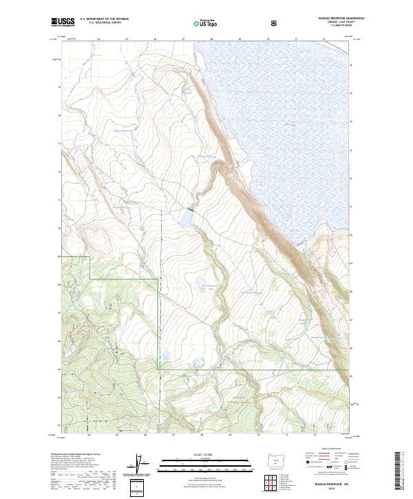
2024 Map of Duncan Reservoir
USGS Topo · Published 2024About this map
Silver Lake dominates the eastern landscape of this high desert region in Lake County, its expansive shoreline defining the local hydrology. This 2024 survey documents a network of seasonal water sources and livestock improvements essential for ranching and forest management, including O'Keefe Waterhole, Dudley Waterhole, and Two Sheep Waterhole. The southern portion of the map transitions into the Fremont National Forest, where the terrain is marked by drainages like Duncan Creek and East Duncan Creek.
Find a feature on this map
28 named features on this map. Tap any name to fly to it.
Don’t see what you’re looking for? This feature index may not catch every label — zoom into the map to look around manually.
Map Details
Editions of this 2024 Duncan Reservoir Map
This is the sole edition of this map. No revisions or reprints were ever made.
Other maps of this area

1889 · Klamath
USGS Topo · 1:250,000

1894 · Klamath
USGS Topo · 1:250,000

1955 · Crescent
USGS Topo · 1:250,000

1955 · Klamath Falls
USGS Topo · 1:250,000

1957 · Crescent
USGS Topo · 1:250,000

1958 · Crescent
USGS Topo · 1:250,000

1958 · Klamath Falls
USGS Topo · 1:250,000

1960 · Sycan Marsh
USGS Topo · 1:62,500

1966 · Summer Lake
USGS Topo · 1:24,000

1966 · Foster Butte
USGS Topo · 1:24,000