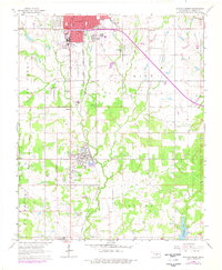
1964 Map of Duncan South
USGS Topo · Published 1977About this map
Duncan serves as the industrial and civic anchor of this region, with the expansive Duncan Cemetery and several schools including Irving Sch and Douglas Sch marking the town's social core. To the south, the settlement of Sunray and the industrial activity of the Oil Field demonstrate the energy-driven economy that shaped Stephens County in the mid-20th century. The landscape is bisected by the Chicago Rock Island and Pacific railroad, which parallels the path of Willow Creek and Claridy Creek.
Find a feature on this map
32 named features on this map. Tap any name to fly to it.
Don’t see what you’re looking for? This feature index may not catch every label — zoom into the map to look around manually.
Map Details
Editions of this 1964 Duncan South Map
2 editions found

Other maps of this area

1901 · Addington
USGS Topo · 1:125,000

1902 · Rush Springs
USGS Topo · 1:125,000

1949 · Nellie
USGS Topo · 1:62,500

1950 · Marlow
USGS Topo · 1:62,500

1951 · Marlow
USGS Topo · 1:62,500

1955 · Lawton
USGS Topo · 1:250,000

1956 · Nellie
USGS Topo · 1:24,000

1956 · Nellie
USGS Topo · 1:62,500

1957 · Ardmore
USGS Topo · 1:250,000

1962 · Temple
USGS Topo · 1:62,500