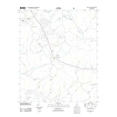
2011 Map of Duncanville
USGS Topo · Published 2011About this map
Duncanville serves as the central hub of this Tuscaloosa County landscape, where the Duncanville Post Office and Duncanville Cemetery anchor a community defined by its proximity to the winding Big Sandy Creek. The area is characterized by a dense network of water bodies and smaller settlements such as Monticello Two and Raintree Country. To the south, the Shiloh Lookout Tower stands near Shiloh Cemetery, one of several burial grounds—including Mount Zion Cemetery and South Sandy Cemetery—that offer significant value for genealogical research in this part of Alabama. The geography transitions from the elevations of Sand Mountain to the agricultural expanses of the Jackson Sod Farm, while numerous drainages like Tadpole Creek and Bear Creek carve through the terrain, illustrating the intricate hydrography of the region during this 2011 survey.
Find a feature on this map
74 named features on this map. Tap any name to fly to it.
Don’t see what you’re looking for? This feature index may not catch every label — zoom into the map to look around manually.
Map Details
Editions of this 2011 Duncanville Map
This is the sole edition of this map. No revisions or reprints were ever made.
Other maps of this area

1899 · Brookwood
USGS Topo · 1:125,000

1924 · Tuscaloosa
USGS Topo · 1:62,500

1926 · Tuscaloosa
USGS Topo · 1:62,500

1931 · Cottondale
USGS Topo · 1:48,000

1934 · Cottondale
USGS Topo · 1:62,500

1953 · Montgomery
USGS Topo · 1:250,000

1953 · Birmingham
USGS Topo · 1:250,000

1956 · Birmingham
USGS Topo · 1:250,000

1956 · Montgomery
USGS Topo · 1:250,000

1957 · Birmingham
USGS Topo · 1:250,000