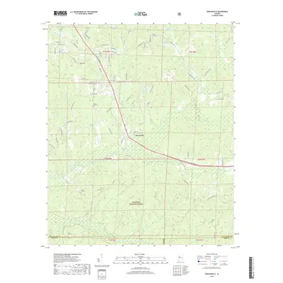
2018 Map of Duncanville
USGS Topo · Published 2018About this map
Duncanville sits at the junction of modern transit and preserved woodlands, dominated by the northern reaches of the Talladega National Forest. The landscape is defined by the winding course of Big Sandy Creek and its many tributaries, including Tadpole Cr and Indian Creek Cutoff. While the northern portion of the map shows residential development along McFarland Blvd E and family-named routes like Price Rd, the southern half transitions into more densely forested terrain. Genealogists and local historians can find several established landmarks, notably Mount Olive Cem, Mount Zion Cem, and Shiloh Cem, which anchor the rural communities surrounding the central settlement. The map also features numerous small lakes, such as Warrior Lake and Matthews Lake, illustrating the water-rich geography of this part of Tuscaloosa County.
Find a feature on this map
86 named features on this map. Tap any name to fly to it.
Don’t see what you’re looking for? This feature index may not catch every label — zoom into the map to look around manually.
Map Details
Editions of this 2018 Duncanville Map
This is the sole edition of this map. No revisions or reprints were ever made.
Other maps of this area

1899 · Brookwood
USGS Topo · 1:125,000

1924 · Tuscaloosa
USGS Topo · 1:62,500

1926 · Tuscaloosa
USGS Topo · 1:62,500

1931 · Cottondale
USGS Topo · 1:48,000

1934 · Cottondale
USGS Topo · 1:62,500

1953 · Montgomery
USGS Topo · 1:250,000

1953 · Birmingham
USGS Topo · 1:250,000

1956 · Birmingham
USGS Topo · 1:250,000

1956 · Montgomery
USGS Topo · 1:250,000

1957 · Birmingham
USGS Topo · 1:250,000