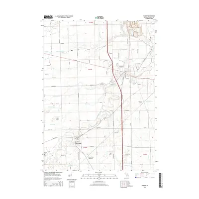
2014 Map of Dundee
USGS Topo · Published 2014About this map
The River Raisin and its numerous tributaries, including the Little River Raisin and Macon Cr, define the agricultural and residential landscape of this Monroe County region. The community of Dundee serves as a central hub, where the river bends sharply near Maple Grove Cem and local streets like E Main St and Plank St intersect. Further south, the settlement of Petersburg sits near Petersburg Junction, illustrating the historical importance of rail and road connectivity in rural Michigan.
Find a feature on this map
75 named features on this map. Tap any name to fly to it.
Don’t see what you’re looking for? This feature index may not catch every label — zoom into the map to look around manually.
Map Details
Editions of this 2014 Dundee Map
This is the sole edition of this map. No revisions or reprints were ever made.
Other maps of this area

1902 · Ypsilanti
USGS Topo · 1:62,500

1904 · Ann Arbor
USGS Topo · 1:125,000

1906 · Ypsilanti
USGS Topo · 1:62,500

1906 · Saline
USGS Topo · 1:62,500

1908 · Ann Arbor
USGS Topo · 1:125,000

1912 · Dundee
USGS Topo · 1:62,500

1926 · Dundee
USGS Topo · 1:62,500

1936 · Samaria
USGS Topo · 1:31,680
1936 · Maybee
USGS Topo · 1:31,680
1936 · Ida
USGS Topo · 1:31,680