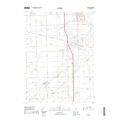
2019 Map of Dundee
USGS Topo · Published 2019About this map
Dundee and Petersburg serve as the primary anchors of this Monroe County landscape, where the winding course of the River Raisin dictates the local geography. The area is defined by an extensive network of drainage systems, including the Macon Cr and Little River Raisin, which supported the agricultural development of Ida Township. This modern survey illustrates the transition from traditional rail-side settlements like Diann and Petersburg Junction to contemporary features such as Lada Airport and the expansive Gradolph Field. Genealogists will find significant value in the detailed plotting of several local burying grounds, including Summerfield Cem, Oak Grove Cem, and Barber Cem. The map provides a clear look at the intersection of rural infrastructure and small-town growth, centered around the established street grids of the historic village centers.
Find a feature on this map
131 named features on this map. Tap any name to fly to it.
Don’t see what you’re looking for? This feature index may not catch every label — zoom into the map to look around manually.
Map Details
Editions of this 2019 Dundee Map
This is the sole edition of this map. No revisions or reprints were ever made.
Other maps of this area

1902 · Ypsilanti
USGS Topo · 1:62,500

1904 · Ann Arbor
USGS Topo · 1:125,000

1906 · Ypsilanti
USGS Topo · 1:62,500

1906 · Saline
USGS Topo · 1:62,500

1908 · Ann Arbor
USGS Topo · 1:125,000

1912 · Dundee
USGS Topo · 1:62,500

1926 · Dundee
USGS Topo · 1:62,500

1936 · Samaria
USGS Topo · 1:31,680
1936 · Maybee
USGS Topo · 1:31,680
1936 · Ida
USGS Topo · 1:31,680