
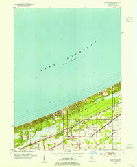
1953 Map of Dune Acres
USGS Topo · Published 1955About this map
Indiana Dunes State Park dominates the Lake Michigan shoreline in this mid-century survey, showcasing the dramatic elevations of Mt Tom, Mt Holden, and Mt Jackson. The landscape is a complex intersection of coastal conservation and heavy industrial transportation, with three major rail lines—the Chicago South Shore and South Bend RR, New York Central, and Chesapeake and Ohio—paralleling the shore just south of the dunes.
Find a feature on this map
22 named features on this map. Tap any name to fly to it.
Don’t see what you’re looking for? This feature index may not catch every label — zoom into the map to look around manually.
Map Details
Editions of this 1953 Dune Acres Map
2 editions found
Other maps of this area

1934 · Porter
USGS Topo · 1:48,000

1940 · Porter
USGS Topo · 1:62,500

1953 · Garyton
USGS Topo · 1:24,000

1953 · Westville
USGS Topo · 1:24,000

1953 · Ogden Dunes
USGS Topo · 1:24,000

1953 · Chesterton
USGS Topo · 1:24,000

1953 · Michigan City West
USGS Topo · 1:24,000

1953 · Chicago
USGS Topo · 1:250,000

1957 · Chicago
USGS Topo · 1:250,000
1960 · Portage
USGS Topo · 1:24,000