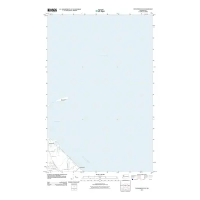
2011 Map of Dungeness OE E
USGS Topo · Published 2011About this map
The New Dungeness Lighthouse stands as a lonely sentinel at the tip of the spit, overlooking the expansive waters of the Strait of Juan de Fuca and the protected Dungeness Bay. This 2011 survey captures the coastal landscape of Clallam County, where the historic settlement of Dungeness and the tribal community of Jamestown are defined by their proximity to the water. The map shows a transition from the maritime environment to the inland road network, featuring local thoroughfares like Sequim Dungeness Way and V Crabb Rd. A notable industrial feature, the Kirner Pit, contrasts with the residential clusters along Friendly Ln and Primrose Ln. The drainage of Cassalery Creek moves toward the shore near Jamestown Rd, illustrating the intersection of natural hydrology and modern land use.
Find a feature on this map
16 named features on this map. Tap any name to fly to it.
Don’t see what you’re looking for? This feature index may not catch every label — zoom into the map to look around manually.
Map Details
Editions of this 2011 Dungeness OE E Map
This is the sole edition of this map. No revisions or reprints were ever made.
Other maps of this area

1938 · Dungeness
USGS Topo · 1:62,500

1939 · Port Townsend
USGS Topo · 1:62,500

1939 · Dungeness
USGS Topo · 1:62,500

1943 · Richardson
USGS Topo · 1:62,500
1953 · Gardiner
USGS Topo · 1:24,000

1956 · Sequim
USGS Topo · 1:24,000
1956 · Carlsborg
USGS Topo · 1:24,000

1957 · Richardson
USGS Topo · 1:62,500

1957 · Victoria
USGS Topo · 1:250,000
1975 · Port Townsend
USGS Topo · 1:100,000