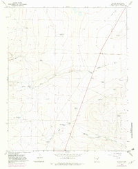
1967 Map of Dunlap
USGS Topo · Published 1982About this map
Dunlap serves as the central point in this New Mexico landscape, a region defined by its critical reliance on water management and ranching operations. The terrain is marked by a network of drainage features like Arroyo de la Mora and Wylie Draw, where seasonal flows are harnessed through numerous man-made structures such as Grasshopper Tank, Shirley Tank, and Easley Tank. These catchments, along with named springs like Arroyo de la Mora Springs, supported the local livestock economy in the mid-20th century.
Find a feature on this map
24 named features on this map. Tap any name to fly to it.
Don’t see what you’re looking for? This feature index may not catch every label — zoom into the map to look around manually.
Map Details
Editions of this 1967 Dunlap Map
2 editions found
Other maps of this area

1954 · Fort Sumner
USGS Topo · 1:250,000

1955 · Roswell
USGS Topo · 1:250,000

1958 · Fort Sumner
USGS Topo · 1:250,000

1958 · Roswell
USGS Topo · 1:250,000

1962 · Roswell
USGS Topo · 1:250,000

1967 · Dunlap NE
USGS Topo · 1:24,000

1967 · Dunlap Sill
USGS Topo · 1:24,000

1967 · Conejo Creek West
USGS Topo · 1:24,000

1967 · Swallow Nest Canyon
USGS Topo · 1:24,000

1967 · Devils Well
USGS Topo · 1:24,000