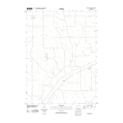
2010 Map of Dunlap NE
USGS Topo · Published 2010About this map
The Boyer River valley carves through the landscape of Crawford County, Iowa, providing a natural corridor for transportation and settlement. Near the small community of Haley, the river is paralleled by primary roads, while the surrounding uplands are defined by a grid of agricultural routes and named ridges such as Dane Ridge RD and Meeves Ridge RD. This land is deeply dissected by a network of waterways including Middle Willow Creek, Welsh Creek, and Buss Creek, which historically dictated the placement of early homesteads and communal sites. For those researching local roots, the map provides precise locations for the Willow Township Cemetery in the northwest and the Dow City Cemetery to the east. The small settlement of Paradise stands at the junction of local roads, reflecting the modest, decentralized rural hubs typical of the region's late 20th and early 21st-century agricultural character.
Find a feature on this map
31 named features on this map. Tap any name to fly to it.
Don’t see what you’re looking for? This feature index may not catch every label — zoom into the map to look around manually.
Map Details
Editions of this 2010 Dunlap NE Map
This is the sole edition of this map. No revisions or reprints were ever made.
Other maps of this area

1954 · Omaha
USGS Topo · 1:250,000

1954 · Fort Dodge
USGS Topo · 1:250,000

1957 · Omaha
USGS Topo · 1:250,000

1957 · Fort Dodge
USGS Topo · 1:250,000

1958 · Omaha
USGS Topo · 1:250,000

1958 · Fort Dodge
USGS Topo · 1:250,000

1971 · Earling
USGS Topo · 1:24,000

1971 · Ute
USGS Topo · 1:24,000

1971 · Dunlap SW
USGS Topo · 1:24,000

1971 · Dunlap
USGS Topo · 1:24,000