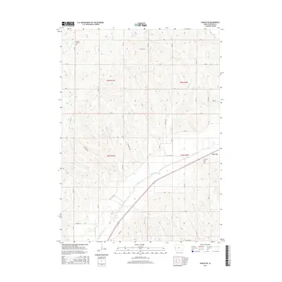
2015 Map of Dunlap NE
USGS Topo · Published 2015About this map
Boyer River meanders through the southeast corner of this Crawford County landscape, where the settlement of Dow City serves as a primary local landmark. The terrain is defined by a dense network of drainages including Welsh Cr, Buss Cr, and Middle Willow Cr, which carve through the agricultural uplands. Rural life is anchored by longstanding landmarks such as the Willow Township Cem and Dow City Cem, providing important touchstones for genealogical research. The road system, characterized by routes like Dane Ridge Rd and Meeves Ridge Rd, reflects a classic Midwestern section-line grid adapted to the local topography. This 2015 survey provides a contemporary perspective on the township boundaries of T83N and T82N, showing the intersection of natural waterways and established land divisions in western Iowa.
Find a feature on this map
26 named features on this map. Tap any name to fly to it.
Don’t see what you’re looking for? This feature index may not catch every label — zoom into the map to look around manually.
Map Details
Editions of this 2015 Dunlap NE Map
This is the sole edition of this map. No revisions or reprints were ever made.
Other maps of this area

1954 · Omaha
USGS Topo · 1:250,000

1954 · Fort Dodge
USGS Topo · 1:250,000

1957 · Omaha
USGS Topo · 1:250,000

1957 · Fort Dodge
USGS Topo · 1:250,000

1958 · Omaha
USGS Topo · 1:250,000

1958 · Fort Dodge
USGS Topo · 1:250,000

1971 · Earling
USGS Topo · 1:24,000

1971 · Ute
USGS Topo · 1:24,000

1971 · Dunlap SW
USGS Topo · 1:24,000

1971 · Dunlap
USGS Topo · 1:24,000