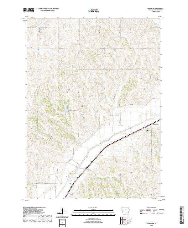
2022 Map of Dunlap NE
USGS Topo · Published 2022About this map
Boyer River valleys and dissected uplands define this Crawford County landscape, where the settlement of Dow City serves as a primary local hub. The map illustrates a highly organized section-line road network typical of the Iowa grain belt, with routes like Dane Ridge Rd and Reeves Ridge Rd traversing the higher ground between drainage basins. For genealogists, the placement of the Willow Township Cem and Dow City Cem provides specific points of interest for family history research. The intricate creek systems, including Middle Willow Cr, Welsh Cr, and Buss Cr, show the natural drainage patterns that have shaped agricultural land use and property boundaries in this part of the state.
Find a feature on this map
40 named features on this map. Tap any name to fly to it.
Don’t see what you’re looking for? This feature index may not catch every label — zoom into the map to look around manually.
Map Details
Editions of this 2022 Dunlap NE Map
This is the sole edition of this map. No revisions or reprints were ever made.
Other maps of this area

1954 · Omaha
USGS Topo · 1:250,000

1954 · Fort Dodge
USGS Topo · 1:250,000

1957 · Omaha
USGS Topo · 1:250,000

1957 · Fort Dodge
USGS Topo · 1:250,000

1958 · Omaha
USGS Topo · 1:250,000

1958 · Fort Dodge
USGS Topo · 1:250,000

1971 · Earling
USGS Topo · 1:24,000

1971 · Ute
USGS Topo · 1:24,000

1971 · Dunlap SW
USGS Topo · 1:24,000

1971 · Dunlap
USGS Topo · 1:24,000