
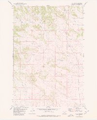
1980 Map of Dunn Mountain North
USGS Topo · Published 1980About this map
Dunn Mountain anchors this 1980 study of the high country along the border of Musselshell and Yellowstone Counties. The landscape is defined by its complex drainage network and numerous water sources, including the headwaters of East Spring Creek, Fattig Creek, and Dutch Oven Creek. The terrain is marked by isolated peaks such as Johnston Mountain and several named springs and wells that supported ranching and transit through this portion of the northern plains. The presence of Railroad Creek suggests the historical pathways carved through these ridges, while features like Rehder Water reflect the vital importance of water management in this arid environment. This map serves as a clear record of the late 20th-century topography before modern developments changed the character of these rural county lines.
Find a feature on this map
10 named features on this map. Tap any name to fly to it.
Don’t see what you’re looking for? This feature index may not catch every label — zoom into the map to look around manually.
Map Details
Editions of this 1980 Dunn Mountain North Map
This is the sole edition of this map. No revisions or reprints were ever made.
Other maps of this area

1954 · Roundup
USGS Topo · 1:250,000

1958 · Roundup
USGS Topo · 1:250,000

1979 · Roundup
USGS Topo · 1:100,000

1979 · Gage NE
USGS Topo · 1:24,000

1979 · Chimney Butte
USGS Topo · 1:24,000

1979 · Gage
USGS Topo · 1:24,000

1980 · Cherry Spring
USGS Topo · 1:24,000

1980 · Dunn Mountain South
USGS Topo · 1:24,000

1980 · Signal Mountain
USGS Topo · 1:24,000
1980 · P K Ranch
USGS Topo · 1:24,000