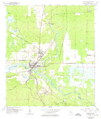
1954 Map of Dunnellon
USGS Topo · Published 1974About this map
The Withlacoochee River carves through the landscape of the Marion and Citrus County border, serving as a focal point for the settlement of Dunnellon. In the mid-1950s, the area's economy is clearly defined by its natural resources and transportation networks. Multiple Tailings Ponds and an Inactive Mine point to the region's history with phosphate mining, while the intersection of the Atlantic Coast Line and Seaboard Air Line railroads at Chatmar highlights its role as a regional transit hub. To the north, the clear waters of Blue Run flow from Rainbow Springs, where Rainbow Falls and a local waterfall mark the transition of the Floridan aquifer to the surface. Local history is further preserved in landmarks such as Rockwell Cem and the Dunnellon Lookout Tower, which monitored the surrounding pine and hardwood forests.
Find a feature on this map
27 named features on this map. Tap any name to fly to it.
Don’t see what you’re looking for? This feature index may not catch every label — zoom into the map to look around manually.
Map Details
Editions of this 1954 Dunnellon Map
3 editions found
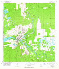
Other maps of this area

1892 · Dunnellon
USGS Topo · 1:62,500

1894 · Dunnellon
USGS Topo · 1:62,500

1895 · Tsala Apopka
USGS Topo · 1:62,500

1954 · Holder
USGS Topo · 1:24,000

1954 · Crystal River
USGS Topo · 1:24,000

1954 · Romeo
USGS Topo · 1:24,000

1954 · Tsala Apopka NE
USGS Topo · 1:24,000

1954 · Dunnellon
USGS Topo · 1:24,000

1954 · Cotton Plant
USGS Topo · 1:24,000

1954 · Dunnellon SE
USGS Topo · 1:24,000