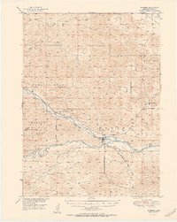
1951 Map of Dunning
USGS Topo · Published 1951About this map
Dunning serves as the central hub of this Nebraska Sandhills region, situated at the confluence where the Dismal River meets the Middle Loup River. The landscape is defined by its educational and ranching network, featuring a high density of rural schools such as Mizpah Sch, Warren Sch, and Wild Horse Sch scattered across the undulating terrain. A distinct shift in land use is visible south of the rivers, where the Nebraska National Forest begins, marked by the Forest Boundary. The transportation corridor is anchored by the Chicago Burlington and Quincy railroad, which follows the northern bank of the Middle Loup. Interesting local details include a Gaging Sta near the town center and two different locations for the Hardscrabble schoolhouse, including the Hardscrabble Sch (Abandoned) site, reflecting the changing settlement patterns of the mid-20th century.
Find a feature on this map
20 named features on this map. Tap any name to fly to it.
Don’t see what you’re looking for? This feature index may not catch every label — zoom into the map to look around manually.
Map Details
Editions of this 1951 Dunning Map
2 editions found
Other maps of this area

1948 · Linscott
USGS Topo · 1:62,500

1948 · Halsey
USGS Topo · 1:62,500

1949 · Purdum
USGS Topo · 1:62,500

1949 · Koshopah
USGS Topo · 1:62,500

1950 · Linscott
USGS Topo · 1:62,500

1950 · Halsey
USGS Topo · 1:62,500

1951 · Dunning
USGS Topo · 1:62,500

1951 · Purdum
USGS Topo · 1:62,500

1951 · Koshopah
USGS Topo · 1:62,500

1951 · Hoagland
USGS Topo · 1:62,500