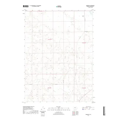
2017 Map of Dunning NE
USGS Topo · Published 2017About this map
Hawley Flats characterizes the high, rolling terrain of Blaine County in this survey of the Nebraska Sandhills. The landscape is defined by its dramatic topographic relief and sparse infrastructure, with the North Loup River cutting across the northeastern corner. This watercourse serves as the primary drainage for the surrounding basins, which are punctuated by isolated wetlands and seasonal depressions. The road network, including Holly Flats Rd and Sandhills Dr, follows the natural contours of the land rather than a rigid grid, reflecting the challenges of navigating this unique prairie environment. Rural access points like Hawley Flats Ave and W North Loup Rd provide the only significant markers of human activity in an area dominated by vast ecological systems and traditional grazing lands.
Find a feature on this map
12 named features on this map. Tap any name to fly to it.
Don’t see what you’re looking for? This feature index may not catch every label — zoom into the map to look around manually.
Map Details
Editions of this 2017 Dunning NE Map
This is the sole edition of this map. No revisions or reprints were ever made.
Other maps of this area

1949 · Koshopah
USGS Topo · 1:62,500

1951 · Dunning
USGS Topo · 1:62,500

1951 · Koshopah
USGS Topo · 1:62,500

1952 · Brewster SW
USGS Topo · 1:24,000

1952 · Brewster NW
USGS Topo · 1:24,000

1954 · North Platte
USGS Topo · 1:250,000

1955 · Broken Bow
USGS Topo · 1:250,000

1955 · O'Neill
USGS Topo · 1:250,000

1956 · Broken Bow
USGS Topo · 1:250,000

1956 · North Platte
USGS Topo · 1:250,000