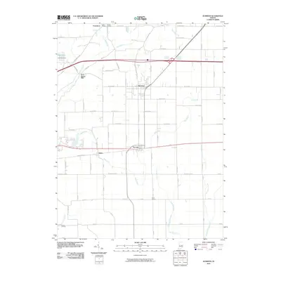
2010 Map of Dunreith
USGS Topo · Published 2010About this map
Dunreith and Spiceland anchor this Henry County landscape, where the agricultural grid is deeply intertwined with the hydrologic network of the Big Blue River and Little Blue River. The area shows a mature rural infrastructure, characterized by long-standing burial grounds such as Mason Cemetery and Hickside Cemetery near Greensboro, and the Shiloh Cemetery further south. A notable industrial legacy is found at Stone Quarry Mills, situated along the winding banks of the Big Blue River. The map illustrates how transportation evolved from the Old National Rd near Ogden to the modern corridors that bypass these historic settlements. Water management is evident at Lake Haven and the Lake Haven Dam, while numerous smaller tributaries like Duck Creek and Shankatank Creek drain the surrounding fields, defining the local topography and property boundaries.
Find a feature on this map
68 named features on this map. Tap any name to fly to it.
Don’t see what you’re looking for? This feature index may not catch every label — zoom into the map to look around manually.
Map Details
Editions of this 2010 Dunreith Map
This is the sole edition of this map. No revisions or reprints were ever made.
Other maps of this area

1948 · Lewisville
USGS Topo · 1:24,000

1949 · New Castle West
USGS Topo · 1:24,000

1950 · New Castle East
USGS Topo · 1:24,000

1950 · Dunreith
USGS Topo · 1:24,000

1950 · Lewisville
USGS Topo · 1:24,000

1953 · Cincinnati
USGS Topo · 1:250,000

1957 · Cincinnati
USGS Topo · 1:250,000

1959 · Mays
USGS Topo · 1:24,000

1959 · Falmouth
USGS Topo · 1:24,000

1960 · New Castle West
USGS Topo · 1:24,000