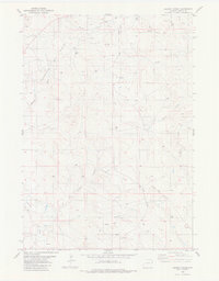
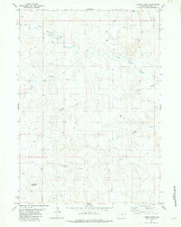
1982 Map of Dupont Creek
USGS Topo · Published 1982About this map
The energy-producing landscape of Weston County is defined by extensive petroleum exploration in the early 1980s. The northern reaches are dominated by the Clareton Oil Field, while the southern portion transition into the Finn Oil Field, both marked by a dense network of scattered Oil Wells and Drill Holes. This industrial activity follows the natural contours of the High Plains drainage systems, where intermittent waters carve deep paths through the terrain. To the south, Dupont Creek and Lodgepole Creek provide significant landmarks, while the central and eastern sections are segmented by the branching waters of Lone Tree Creek and Louse Creek. The network of Grieves Road and various unnamed trails provides the primary access to the isolated well sites and draws such as Statler Draw and Newton Draw, reflecting a specialized landscape of Wyoming's resource economy.
Find a feature on this map
15 named features on this map. Tap any name to fly to it.
Don’t see what you’re looking for? This feature index may not catch every label — zoom into the map to look around manually.
Map Details
Editions of this 1982 Dupont Creek Map
This is the sole edition of this map. No revisions or reprints were ever made.
Other maps of this area

1899 · Newcastle
USGS Topo · 1:125,000

1901 · Newcastle
USGS Topo · 1:125,000

1955 · Newcastle
USGS Topo · 1:250,000

1958 · Newcastle
USGS Topo · 1:250,000
1972 · Klodt Reservoir
USGS Topo · 1:24,000

1979 · Newcastle
USGS Topo · 1:100,000
1982 · Morrisey
USGS Topo · 1:24,000

1982 · Clareton
USGS Topo · 1:24,000
1982 · The Nose East
USGS Topo · 1:24,000
1982 · Timber Creek
USGS Topo · 1:24,000