
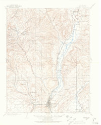
1907 Map of Durango
USGS Topo · Published 1955About this map
Durango serves as the industrial hub for the Animas Valley on this early 20th-century survey, which details the region's transition from raw wilderness to a mining and transportation center. The local economy is anchored by the Durango Smelter and the Boston Coal Mine near the settlement of Perins. Further north, resource extraction is represented by the Neglected Mine and Oro Fino Mill tucked into the high gulches.
Find a feature on this map
70 named features on this map. Tap any name to fly to it.
Don’t see what you’re looking for? This feature index may not catch every label — zoom into the map to look around manually.
Map Details
Editions of this 1907 Durango Map
2 editions found
Other maps of this area

1895 · La Plata
USGS Topo · 1:62,500

1897 · La Plata
USGS Topo · 1:62,500

1897 · Rico
USGS Topo · 1:62,500

1898 · Durango
USGS Topo · 1:62,500

1898 · Engineer Mountain
USGS Topo · 1:62,500

1898 · Rico
USGS Topo · 1:62,500

1899 · La Plata
USGS Topo · 1:62,500

1899 · Rico
USGS Topo · 1:62,500

1900 · Engineer Mountain
USGS Topo · 1:62,500

1900 · Needle Mountains
USGS Topo · 1:62,500