
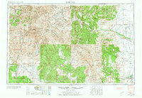
1945 Map of Durango
USGS Topo · Published 1945About this map
The San Juan Mountains dominate this mid-century landscape, a terrain defined by the Continental Divide and the headwaters of several major Western river systems. The industrial and agricultural development of Southwest Colorado is visible through the narrow-gauge operations of the D & R G W RR, which connects the mining center of Silverton with the regional hub of Durango. To the south, the Southern Ute Indian Reservation and Jicarilla Apache Indian Reservation cover significant acreage, while irrigation and water management are reflected in the presence of the Vallecito Reservoir and Rio Grande Reservoir. Local education and social hubs appear as isolated points in the high country, such as the Blanco Basin School. Small settlements like Ignacio, Arboles, and Allison dot the landscape near the New Mexico border, illustrating the distribution of rural communities in this transition between high peaks and desert plateaus.
Find a feature on this map
65 named features on this map. Tap any name to fly to it.
Don’t see what you’re looking for? This feature index may not catch every label — zoom into the map to look around manually.
Map Details
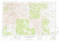
Editions of this 1945 Durango Map
3 editions found
Other maps of this area

1889 · Largo
USGS Topo · 1:250,000

1889 · Chaco
USGS Topo · 1:250,000

1892 · Chaco
USGS Topo · 1:250,000

1895 · Largo
USGS Topo · 1:250,000

1895 · La Plata
USGS Topo · 1:62,500

1897 · La Plata
USGS Topo · 1:62,500

1897 · Rico
USGS Topo · 1:62,500

1897 · Telluride
USGS Topo · 1:62,500

1897 · Silverton
USGS Topo · 1:62,500

1898 · Durango
USGS Topo · 1:62,500