
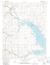
1971 Map of Durham
USGS Topo · Published 1972About this map
Durham serves as a focal point for this section of Marion County, where the Chicago Rock Island and Pacific railroad cuts through the landscape. The early 1970s marked a significant period of topographical change for the area with the presence of the Marion Reservoir, which dominates the eastern half of the map. This man-made feature transformed the drainage patterns of the North Cottonwood River and French Creek, creating new recreational spaces like the Durham Cove Public Use Area.
Find a feature on this map
19 named features on this map. Tap any name to fly to it.
Don’t see what you’re looking for? This feature index may not catch every label — zoom into the map to look around manually.
Map Details
Editions of this 1971 Durham Map
2 editions found
Other maps of this area

1889 · Newton
USGS Topo · 1:125,000

1889 · Abilene
USGS Topo · 1:125,000

1894 · Newton
USGS Topo · 1:125,000

1894 · Abilene
USGS Topo · 1:125,000

1955 · Hutchinson
USGS Topo · 1:250,000

1959 · Hutchinson
USGS Topo · 1:250,000

1964 · Ramona
USGS Topo · 1:24,000
1964 · Gypsum SE
USGS Topo · 1:24,000
1964 · Tampa
USGS Topo · 1:24,000
1971 · Lehigh
USGS Topo · 1:24,000