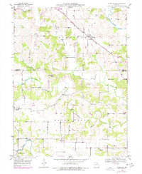
1949 Map of Durham
USGS Topo · Published 1977About this map
Middle Fabius River and its meandering tributaries define the landscape of Marion and Lewis counties in the late 1940s. The region is characterized by small, scattered settlements such as Durham, Emerson, and Hester, which serve as focal points for the surrounding agricultural community. Transportation and trade are anchored by the Burlington Northern railroad, which cuts diagonally across the northern portion of the sheet through Highland. Local history is preserved in small landmarks like Mount Sinai Ch and several family-named burial sites including Wagner Cem, Banks Cem, and McPike Cem. The drainage patterns of Troublesome Creek and Grassy Creek illustrate the natural topography of Round Grove, providing a clear picture of the rural infrastructure and land use before later twentieth-century developments altered the local character.
Find a feature on this map
18 named features on this map. Tap any name to fly to it.
Don’t see what you’re looking for? This feature index may not catch every label — zoom into the map to look around manually.
Map Details
Editions of this 1949 Durham Map
2 editions found
Other maps of this area

1903 · Kahoka
USGS Topo · 1:125,000

1903 · Palmyra
USGS Topo · 1:125,000

1948 · Quincy
USGS Topo · 1:250,000

1949 · Durham
USGS Topo · 1:24,000

1949 · Maywood
USGS Topo · 1:24,000

1949 · Palmyra
USGS Topo · 1:24,000

1949 · Philadelphia
USGS Topo · 1:24,000
1950 · Maywood
USGS Topo · 1:24,000

1950 · Durham
USGS Topo · 1:24,000

1950 · Palmyra
USGS Topo · 1:24,000