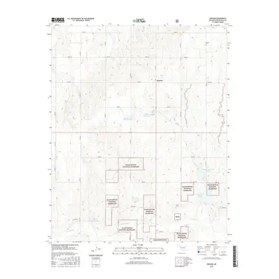
2016 Map of Durham
USGS Topo · Published 2016About this map
Black Kettle National Grassland dominates this portion of Roger Mills County, where the plains are defined by a complex system of water management and rural settlement. The community of Durham serves as a central point in a landscape marked by numerous reservoirs, including Upper Washita Site 104 Reservoir and Upper Washita Site 103 Reservoir, which regulate the drainage of Turkey Cr as it moves toward the Washita River. These man-made features illustrate the mid-century transition toward intensive soil and water conservation in the Oklahoma Panhandle region. For those researching family history, the map preserves the locations of Fairview Cem in the north and Lindley Cem to the south, alongside an extensive network of section-line roads like e0810 RD and N 1710 RD that still follow the original land survey patterns.
Find a feature on this map
34 named features on this map. Tap any name to fly to it.
Don’t see what you’re looking for? This feature index may not catch every label — zoom into the map to look around manually.
Map Details
Editions of this 2016 Durham Map
This is the sole edition of this map. No revisions or reprints were ever made.
Other maps of this area

1954 · Amarillo
USGS Topo · 1:250,000

1955 · Clinton
USGS Topo · 1:250,000

1957 · Clinton
USGS Topo · 1:250,000

1958 · Amarillo
USGS Topo · 1:250,000

1961 · Reydon
USGS Topo · 1:62,500

1965 · Crawford
USGS Topo · 1:24,000

1966 · Antelope Hills NE
USGS Topo · 1:24,000

1966 · Antelope Hills
USGS Topo · 1:24,000

1966 · Durham
USGS Topo · 1:24,000

1967 · Gem
USGS Topo · 1:24,000