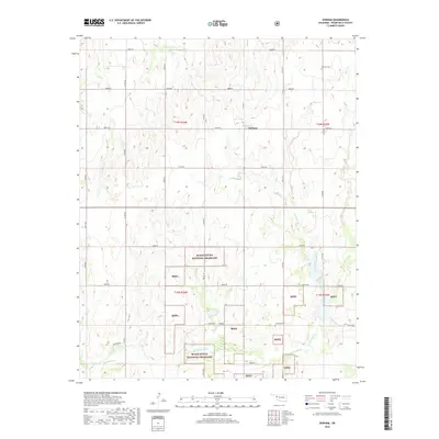
2018 Map of Durham
USGS Topo · Published 2018About this map
Durham serves as a central point in this Roger Mills County landscape, which is characterized by the expansive holdings of the Black Kettle National Grassland. The southern portion of the map is defined by the winding course of the Washita River, which is fed by several tributaries including Turkey Creek and Trunk Creek. The terrain is marked by a distinctive grid of rural roads, such as Mathers Rd, that connect isolated homesteads and grazing lands. For genealogists, the map preserves the locations of local burial grounds like Fairview Cemetery in the northeast and Lindley Cemetery further south, providing essential markers for family history research in this western Oklahoma prairie. The distribution of Bkng parcels illustrates the patchwork nature of public and private land management typical of this region's agricultural and conservation history.
Find a feature on this map
36 named features on this map. Tap any name to fly to it.
Don’t see what you’re looking for? This feature index may not catch every label — zoom into the map to look around manually.
Map Details
Editions of this 2018 Durham Map
This is the sole edition of this map. No revisions or reprints were ever made.
Other maps of this area

1954 · Amarillo
USGS Topo · 1:250,000

1955 · Clinton
USGS Topo · 1:250,000

1957 · Clinton
USGS Topo · 1:250,000

1958 · Amarillo
USGS Topo · 1:250,000

1961 · Reydon
USGS Topo · 1:62,500

1965 · Crawford
USGS Topo · 1:24,000

1966 · Antelope Hills NE
USGS Topo · 1:24,000

1966 · Antelope Hills
USGS Topo · 1:24,000

1966 · Durham
USGS Topo · 1:24,000

1967 · Gem
USGS Topo · 1:24,000