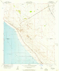
1956 Map of Durmid
USGS Topo · Published 1957About this map
The eastern shoreline of the Salton Sea is defined by a narrow strip of development and infrastructure squeezed between the water and the arid desert uplands. Along the Southern Pacific railroad line, small sidings and stops like Ferrum, Durmid, and Bertram mark the transportation corridor through the Colorado Desert. The landscape is a mix of industrial extraction and military presence, evidenced by the Bertram Mine and the sprawling Chocolate Mountain Aerial Gunnery Range to the east.
Find a feature on this map
33 named features on this map. Tap any name to fly to it.
Don’t see what you’re looking for? This feature index may not catch every label — zoom into the map to look around manually.
Map Details
Editions of this 1956 Durmid Map
3 editions found
Other maps of this area

1940 · Frink
USGS Topo · 1:62,500

1940 · Cottonwood Spring
USGS Topo · 1:62,500

1940 · Canyon Spring
USGS Topo · 1:62,500

1940 · Durmid
USGS Topo · 1:62,500

1943 · Canyon Spring
USGS Topo · 1:62,500

1944 · Cottonwood Spring
USGS Topo · 1:62,500

1944 · Durmid
USGS Topo · 1:62,500

1944 · Frink
USGS Topo · 1:62,500

1954 · Salton Sea
USGS Topo · 1:250,000

1955 · Salton Sea
USGS Topo · 1:250,000