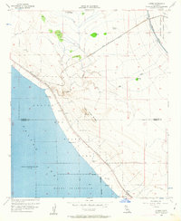
1956 Map of Durmid
USGS Topo · Published 1963About this map
Salton Sea dominates the southwestern corner of this desert landscape, its shoreline recorded at 235 feet below sea level in May 1956. The arid terrain to the northeast is defined by the Southern Pacific Railroad corridor, which links the small settlements of Ferrum, Durmid, and Bertram along the coastal margin. This infrastructure supported local extractive industry, evidenced by the Bertram Mine and a nearby gravel pit located just below the Chocolate Mountain Aerial Gunnery Range.
Find a feature on this map
31 named features on this map. Tap any name to fly to it.
Don’t see what you’re looking for? This feature index may not catch every label — zoom into the map to look around manually.
Map Details
Editions of this 1956 Durmid Map
3 editions found
Other maps of this area

1940 · Frink
USGS Topo · 1:62,500

1940 · Cottonwood Spring
USGS Topo · 1:62,500

1940 · Canyon Spring
USGS Topo · 1:62,500

1940 · Durmid
USGS Topo · 1:62,500

1943 · Canyon Spring
USGS Topo · 1:62,500

1944 · Cottonwood Spring
USGS Topo · 1:62,500

1944 · Durmid
USGS Topo · 1:62,500

1944 · Frink
USGS Topo · 1:62,500

1954 · Salton Sea
USGS Topo · 1:250,000

1955 · Salton Sea
USGS Topo · 1:250,000