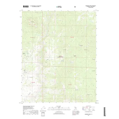
2018 Map of Durrwood Creek
USGS Topo · Published 2018About this map
The Kern River carves a deep valley through this high-elevation portion of the Sequoia National Forest, defining the western reaches of the quadrangle. The terrain is characterized by high alpine meadows and dramatic granite formations, most notably the spires of The Needles overlooking Needlerock Cr. In the southeast, Sherman Peak stands as a prominent high point above North Meadow and Alder Cr. This 2018 survey illustrates the network of Forest Service roads, including Forest Rte 22S89 and Lloyd Rd, that provide access to this backcountry environment. Significant drainage systems like Durrwood Cr and Rattlesnake Cr feed into the central river system, while locations such as Rincon and Peppermint Meadows mark established points along the canyon floor and upper plateaus.
Find a feature on this map
37 named features on this map. Tap any name to fly to it.
Don’t see what you’re looking for? This feature index may not catch every label — zoom into the map to look around manually.
Map Details
Editions of this 2018 Durrwood Creek Map
This is the sole edition of this map. No revisions or reprints were ever made.
Other maps of this area

1904 · Kaweah
USGS Topo · 1:125,000

1905 · Olancha
USGS Topo · 1:125,000

1905 · Fairview
USGS Topo · 1:24,000

1906 · Kernville
USGS Topo · 1:125,000

1907 · Olancha
USGS Topo · 1:125,000

1908 · Kernville
USGS Topo · 1:125,000

1909 · Kaweah
USGS Topo · 1:125,000

1918 · Fairview
USGS Topo · 1:31,680

1936 · Tobias Peak
USGS Topo · 1:125,000

1937 · Kaweah
USGS Topo · 1:125,000