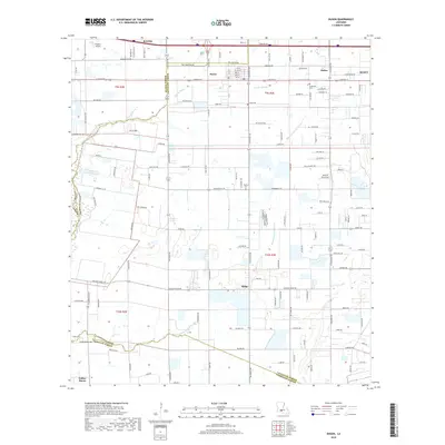
2018 Map of Duson
USGS Topo · Published 2018About this map
Duson and its surrounding prairie landscapes sit at the intersection of Lafayette, Acadia, and Vermilion Parishes in this detailed contemporary record. The area is defined by its agrarian roots and the winding course of the Bayou Queue De Tortue, which meanders across the southern half of the quadrangle. Significant local history is preserved in small rural settlements and cemeteries, including the Indian Bayou Cem and Indian Cem near the southern boundary, as well as Bethel Cem located near the center of the township. In the north, the transport and commerce of the region are reflected in the development of Scott and the proximity to the Phoenix Airport. The map highlights a transition from the structured street grids of established towns to the expansive rural road networks that serve the unincorporated communities of Sadou and Ridge, providing a clear view of the modern infrastructure and legacy landmarks of this part of Acadiana.
Find a feature on this map
78 named features on this map. Tap any name to fly to it.
Don’t see what you’re looking for? This feature index may not catch every label — zoom into the map to look around manually.
Map Details
Editions of this 2018 Duson Map
This is the sole edition of this map. No revisions or reprints were ever made.
Other maps of this area

1934 · Duson
USGS Topo · 1:31,680

1935 · Branch
USGS Topo · 1:31,680

1946 · Milton
USGS Topo · 1:31,680

1946 · Leroy
USGS Topo · 1:31,680

1946 · Lafayette
USGS Topo · 1:31,680

1946 · Kaplan
USGS Topo · 1:31,680

1946 · Rayne
USGS Topo · 1:31,680

1947 · Branch
USGS Topo · 1:31,680

1952 · Lake Charles
USGS Topo · 1:250,000

1954 · Lafayette
USGS Topo · 1:31,680