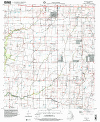
1998 Map of Duson
USGS Topo · Published 2000About this map
Duson serves as a focal point in this Cajun Country landscape, situated at the boundary where Acadia Parish and Lafayette Parish meet. The map reveals a transition from the structured street grid of Duson to the winding watercourses of the Bayou Queue de Tortue and Indian Bayou. This area shows a dense network of local institutions and small settlements, such as Sadou and Ridge, which are often linked to the region's agricultural and social fabric.
Find a feature on this map
22 named features on this map. Tap any name to fly to it.
Don’t see what you’re looking for? This feature index may not catch every label — zoom into the map to look around manually.
Map Details
Editions of this 1998 Duson Map
This is the sole edition of this map. No revisions or reprints were ever made.
Other maps of this area

1934 · Duson
USGS Topo · 1:31,680

1935 · Branch
USGS Topo · 1:31,680

1946 · Milton
USGS Topo · 1:31,680

1946 · Leroy
USGS Topo · 1:31,680

1946 · Lafayette
USGS Topo · 1:31,680

1946 · Kaplan
USGS Topo · 1:31,680

1946 · Rayne
USGS Topo · 1:31,680

1947 · Branch
USGS Topo · 1:31,680

1952 · Lake Charles
USGS Topo · 1:250,000

1954 · Lafayette
USGS Topo · 1:31,680