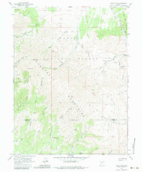
1963 Map of Dutch Peak
USGS Topo · Published 1984About this map
Dutch Peak and Black Peak anchor the high elevations of the Sheeprock Mountains in this early 1960s survey. Located along the border of Tooele and Juab counties, the landscape is defined by a dense network of drainages including Snow Creek, Harker Creek, and Bennion Creek that flow toward the lower Horse Valley. Much of the area is protected within the Wasatch National Forest, where numerous mines and prospects are scattered across the canyons, particularly near Hard to Beat Canyon and Little Valley.
Find a feature on this map
41 named features on this map. Tap any name to fly to it.
Don’t see what you’re looking for? This feature index may not catch every label — zoom into the map to look around manually.
Map Details
Editions of this 1963 Dutch Peak Map
3 editions found
Other maps of this area

1885 · Sevier Desert
USGS Topo · 1:250,000

1885 · Tooele Valley
USGS Topo · 1:250,000

1953 · Tooele
USGS Topo · 1:250,000

1953 · Delta
USGS Topo · 1:250,000

1955 · Tooele
USGS Topo · 1:250,000

1958 · Delta
USGS Topo · 1:250,000

1962 · Delta
USGS Topo · 1:250,000

1963 · Maple Peak
USGS Topo · 1:24,000
1963 · Sabie Mountain
USGS Topo · 1:24,000

1963 · Dutch Peak
USGS Topo · 1:24,000