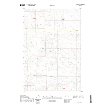
2020 Map of Dutchmans Hill
USGS Topo · Published 2020About this map
Dutchmans Hill stands as a prominent landmark in this section of southeastern Montana, where the terrain transitions across the Fallon Co Carter Co line. The landscape is defined by a dense network of seasonal drainages, including Hagen Cr, Greasewood Cr, and Fletcher Cr, which carve through the high plains. To the south, the Ekalaka Hills rise near the edge of the survey, a region where water sources like Reynolds Spring were historically vital for local ranching operations. The infrastructure here is sparse and functional, centered on remote thoroughfares such as Mill Iron Camp Crook Rd and Mill Iron Rd. This map captures the vast open character of the region, illustrating how the natural topography dictated the placement of early routes and land divisions during the 21st century.
Find a feature on this map
19 named features on this map. Tap any name to fly to it.
Don’t see what you’re looking for? This feature index may not catch every label — zoom into the map to look around manually.
Map Details
Editions of this 2020 Dutchmans Hill Map
This is the sole edition of this map. No revisions or reprints were ever made.
Other maps of this area

1953 · Miles City
USGS Topo · 1:250,000

1954 · Ekalaka
USGS Topo · 1:250,000

1956 · Ekalaka
USGS Topo · 1:250,000

1957 · Miles City
USGS Topo · 1:250,000

1958 · Miles City
USGS Topo · 1:250,000

1958 · Ekalaka
USGS Topo · 1:250,000

1965 · Ekalaka
USGS Topo · 1:250,000

1980 · Camp Needmore
USGS Topo · 1:24,000

1980 · Dutchmans Hill
USGS Topo · 1:24,000
1980 · Lampkin Gulch
USGS Topo · 1:24,000