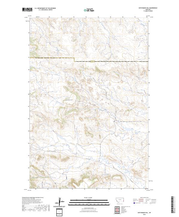
2024 Map of Dutchmans Hill
USGS Topo · Published 2024About this map
Dutchmans Hill stands as the central landmark in this high-plains landscape of Carter and Fallon Counties. This modern survey illustrates a rugged drainage system where Fletcher Creek and Hay Creek cut through the northern terrain, while the Ekalaka Hills rise in the southwest. The presence of Reynolds Spring highlights the vital water sources required for life in this arid region, which is historically tied to ranching and open-range livestock. Transportation through the area relies on established routes such as Mill Iron Camp Crook Rd, reflecting the long-standing land-use patterns of Montana's eastern borderlands. Numerous drainages like Greasewood Creek and Coal Creek carve out the topography, providing a detailed look at the watersheds that define this portion of the northern plains.
Find a feature on this map
19 named features on this map. Tap any name to fly to it.
Don’t see what you’re looking for? This feature index may not catch every label — zoom into the map to look around manually.
Map Details
Editions of this 2024 Dutchmans Hill Map
This is the sole edition of this map. No revisions or reprints were ever made.
Other maps of this area

1953 · Miles City
USGS Topo · 1:250,000

1954 · Ekalaka
USGS Topo · 1:250,000

1956 · Ekalaka
USGS Topo · 1:250,000

1957 · Miles City
USGS Topo · 1:250,000

1958 · Miles City
USGS Topo · 1:250,000

1958 · Ekalaka
USGS Topo · 1:250,000

1965 · Ekalaka
USGS Topo · 1:250,000

1980 · Camp Needmore
USGS Topo · 1:24,000

1980 · Dutchmans Hill
USGS Topo · 1:24,000
1980 · Lampkin Gulch
USGS Topo · 1:24,000