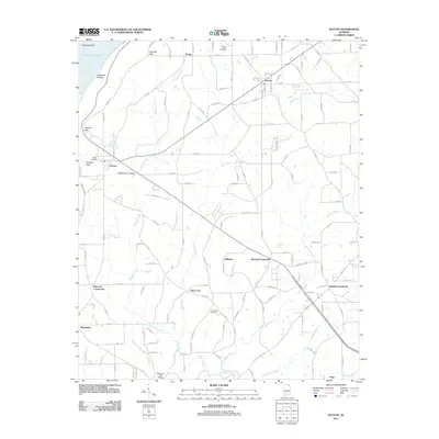
2011 Map of Dutton
USGS Topo · Published 2011About this map
Dutton and several surrounding rural communities anchor this 2011 survey of the Alabama plateau. The landscape is defined by the escarpment above Guntersville Lake, where notable terrain features like Ferncliff Gap, Section Gap, and Gossett Gap mark the transition from the upland down to the river valley. The map reveals a dense network of county roads connecting historical junctions such as Duncan Crossroads, Hancock Crossroads, and Powells Crossroads. Local heritage is preserved in several rural burial grounds, including Chaney Chapel Cemetery and Old Sardis Cemetery. Waterways like Kirby Creek and Stringer Creek drain the plateau, while the Old Sauty Mill Bridge indicates an area of historical industrial significance at the southern edge of the quadrangle near Pope.
Find a feature on this map
138 named features on this map. Tap any name to fly to it.
Don’t see what you’re looking for? This feature index may not catch every label — zoom into the map to look around manually.
Map Details
Editions of this 2011 Dutton Map
This is the sole edition of this map. No revisions or reprints were ever made.
Other maps of this area

1885 · Gadsden
USGS Topo · 1:125,000

1886 · Stevenson
USGS Topo · 1:125,000

1888 · Gadsden
USGS Topo · 1:125,000

1888 · Scottsboro
USGS Topo · 1:125,000

1892 · Scottsboro
USGS Topo · 1:125,000

1892 · Stevenson
USGS Topo · 1:125,000

1892 · Gadsden
USGS Topo · 1:125,000

1893 · Fort Payne
USGS Topo · 1:125,000

1895 · Stevenson
USGS Topo · 1:125,000

1895 · Gadsden
USGS Topo · 1:125,000