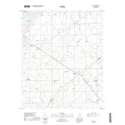
2018 Map of Dutton
USGS Topo · Published 2018About this map
Sand Mountain dominates this portion of Northeast Alabama, where the high plateau drops toward the waters of Guntersville Lake. This 2018 survey reveals a landscape defined by traditional agricultural crossroads and small rural communities like Dutton, Macedonia, and Hodge. The terrain is deeply incised by numerous waterways such as Kirby Cr and Stringer Cr, which carve through features like Weatherley Hollow and Goodman Hollow. Genealogists will find several historic burial sites documented, including Chaney Chapel Cem in the north and Old Sardis Cem near Rock City. The map documents the persistent settlement patterns of the region, where family names are often preserved in landmarks like Chisenhall Bar and Gossett Gap, and local commerce centers around intersections like Duncan Crossroads and Powells Crossroads.
Find a feature on this map
150 named features on this map. Tap any name to fly to it.
Don’t see what you’re looking for? This feature index may not catch every label — zoom into the map to look around manually.
Map Details
Editions of this 2018 Dutton Map
This is the sole edition of this map. No revisions or reprints were ever made.
Other maps of this area

1885 · Gadsden
USGS Topo · 1:125,000

1886 · Stevenson
USGS Topo · 1:125,000

1888 · Gadsden
USGS Topo · 1:125,000

1888 · Scottsboro
USGS Topo · 1:125,000

1892 · Scottsboro
USGS Topo · 1:125,000

1892 · Stevenson
USGS Topo · 1:125,000

1892 · Gadsden
USGS Topo · 1:125,000

1893 · Fort Payne
USGS Topo · 1:125,000

1895 · Stevenson
USGS Topo · 1:125,000

1895 · Gadsden
USGS Topo · 1:125,000