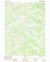
1984 Map of Duzel Rock
USGS Topo · Published 1984About this map
Duzel Rock stands as a prominent landmark in this Siskiyou County landscape, overlooking a complex drainage network within the Klamath National Forest. The 1980s terrain is characterized by deep ravines and gulches that feed into major waterways like Moffett Creek and Cottonwood Creek. The nomenclature of the area, featuring names such as Whiskey Gulch, Moonshine Gulch, and Portuguese Gulch, hints at the colorful local history of prospectors and early settlers who worked these hills. Evidence of resource extraction and land use is found in the scattered Prospects and Borrow Pits documented across the terrain. From the heights of Bald Hill and Antelope Mtn, the map traces the intricate paths of Sissel Gulch and East Ridge Gulch, illustrating the topographical challenges faced by those traversing this part of Northern California.
Find a feature on this map
31 named features on this map. Tap any name to fly to it.
Don’t see what you’re looking for? This feature index may not catch every label — zoom into the map to look around manually.
Map Details
Editions of this 1984 Duzel Rock Map
2 editions found
Other maps of this area

1886 · Shasta
USGS Topo · 1:250,000

1894 · Shasta
USGS Topo · 1:250,000

1922 · Shasta Valley Sheet No 3 S
USGS Topo · 1:24,000

1923 · Sawyers Bar
USGS Topo · 1:125,000

1931 · Etna
USGS Topo · 1:96,000

1932 · Yreka
USGS Topo · 1:96,000

1934 · Etna
USGS Topo · 1:125,000

1939 · Yreka
USGS Topo · 1:125,000

1948 · Weed
USGS Topo · 1:250,000

1950 · Weed
USGS Topo · 1:250,000