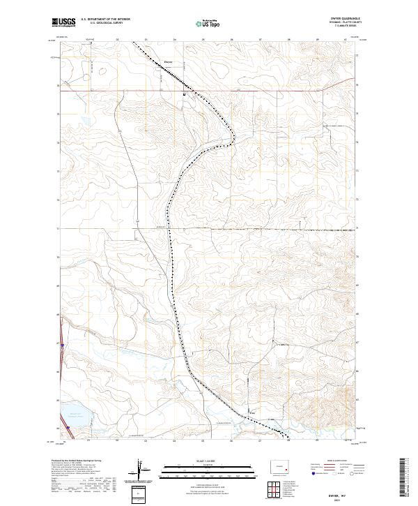
2021 Map of Dwyer
USGS Topo · Published 2021About this map
Dwyer and Uva anchor this portion of Platte County, where the high plains landscape is defined by the critical movement of water. The N Laramie River and the larger Laramie River flow through the southern half of the quadrangle, supported by a network of agricultural infrastructure including the N Laramie Canal, the Uva Ditch, and Reservoir Number Three. This system of waterways suggests a long-standing reliance on irrigation to sustain life and ranching in this arid Wyoming environment. Local history is centered around the settlement at Dwyer, which includes the Dwyer Cem just south of the community center. The map also traces various country routes like Badger RD and Pepper RD, which connect the scattered homesteads across the townships of T25N and T26N.
Find a feature on this map
22 named features on this map. Tap any name to fly to it.
Don’t see what you’re looking for? This feature index may not catch every label — zoom into the map to look around manually.
Map Details
Editions of this 2021 Dwyer Map
This is the sole edition of this map. No revisions or reprints were ever made.
Other maps of this area

1896 · Hartville
USGS Topo · 1:125,000

1901 · Hartville
USGS Topo · 1:125,000

1950 · Coleman Butte
USGS Topo · 1:24,000

1950 · Herman Ranch
USGS Topo · 1:24,000

1950 · Guernsey Reservoir
USGS Topo · 1:24,000

1951 · Coleman Butte
USGS Topo · 1:24,000

1951 · Guernsey Reservoir
USGS Topo · 1:24,000
1951 · Herman Ranch
USGS Topo · 1:24,000

1951 · Dwyer
USGS Topo · 1:24,000

1951 · Antelope Gap
USGS Topo · 1:24,000