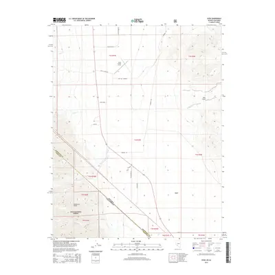
2014 Map of Dyer
USGS Topo · Published 2014About this map
Dyer sits at the transition between the valley floor and the rising slopes of the White-Inyo Range, marking a pocket of settlement along the Nevada-California border. This agricultural landscape is defined by a network of ranch roads, including Stanley Ranch Rd and Circle L Ranch Rd, which connect remote homesteads to the Dyer School and the Circle L Ranch Airport. The presence of the Gone Old Cemetery provides a specific point of interest for genealogists tracing early families in Esmeralda County. The western portion of the map is dominated by the protected lands of the Inyo National Forest, where steep canyons like Piper Canyon and drainage systems such as Leidy Cr and Perry Aiken Cr carve through the high terrain. The land division shows the distinct intersection of state lines and township boundaries within this high-desert basin.
Find a feature on this map
30 named features on this map. Tap any name to fly to it.
Don’t see what you’re looking for? This feature index may not catch every label — zoom into the map to look around manually.
Map Details
Editions of this 2014 Dyer Map
This is the sole edition of this map. No revisions or reprints were ever made.
Other maps of this area

1898 · Silver Peak
USGS Topo · 1:125,000

1900 · Silver Peak
USGS Topo · 1:125,000

1908 · Lida
USGS Topo · 1:250,000

1913 · Lida
USGS Topo · 1:250,000

1917 · White Mountain
USGS Topo · 1:125,000

1947 · Mariposa
USGS Topo · 1:250,000

1948 · Mariposa
USGS Topo · 1:250,000

1954 · Goldfield
USGS Topo · 1:250,000

1955 · Goldfield
USGS Topo · 1:250,000

1957 · Mariposa
USGS Topo · 1:250,000