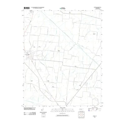
2010 Map of Dyer
USGS Topo · Published 2010About this map
The town of Dyer serves as the primary hub in this West Tennessee landscape, anchored by the Dyer Post Office and bisected by a network of rural routes. The terrain is defined by its drainage patterns, with the Rutherford Fork Obion River winding through the northern reaches while the North Fork Forked Deer River skirts the southern boundary. These waterways, along with smaller tributaries like Owen Branch and Sand Creek, have long dictated the placement of homesteads and agricultural plots throughout Gibson County.
Find a feature on this map
68 named features on this map. Tap any name to fly to it.
Don’t see what you’re looking for? This feature index may not catch every label — zoom into the map to look around manually.
Map Details
Editions of this 2010 Dyer Map
This is the sole edition of this map. No revisions or reprints were ever made.
Other maps of this area

1951 · Trenton
USGS Topo · 1:24,000

1952 · Milan
USGS Topo · 1:24,000

1953 · Dyer
USGS Topo · 1:24,000

1954 · Rutherford
USGS Topo · 1:24,000

1954 · Greenfield
USGS Topo · 1:24,000

1954 · Bradford
USGS Topo · 1:24,000

1956 · Dyersburg
USGS Topo · 1:250,000

1956 · Blytheville
USGS Topo · 1:250,000

1959 · Blytheville
USGS Topo · 1:250,000
1964 · Brazil
USGS Topo · 1:24,000