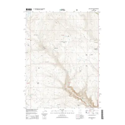
2014 Map of Dyer Mountain
USGS Topo · Published 2014About this map
Bullionville and the high elevations of the Ashley National Forest define this 2014 survey of northeastern Utah. The landscape is a network of complex drainages and springs, including Bullionville Spring, Iron Spring, and the prominent Oaks Park Reservoir in the northwest corner. Elevation changes are marked by dramatic features like Dyer Mtn and the steep walls of Big Brush Gorge.
Find a feature on this map
52 named features on this map. Tap any name to fly to it.
Don’t see what you’re looking for? This feature index may not catch every label — zoom into the map to look around manually.
Map Details
Editions of this 2014 Dyer Mountain Map
This is the sole edition of this map. No revisions or reprints were ever made.
Other maps of this area

1885 · Ashley
USGS Topo · 1:250,000

1906 · Marsh Peak
USGS Topo · 1:125,000

1908 · Marsh Peak
USGS Topo · 1:125,000

1950 · Burnt Cabin Gorge
USGS Topo · 1:24,000

1950 · Dyer Mountain
USGS Topo · 1:24,000

1954 · Vernal
USGS Topo · 1:250,000

1958 · Vernal
USGS Topo · 1:250,000

1960 · Vernal
USGS Topo · 1:250,000
1963 · East Park Reservoir
USGS Topo · 1:24,000
1963 · Elk Park
USGS Topo · 1:24,000