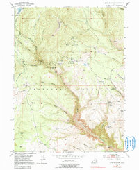
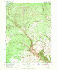
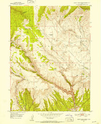
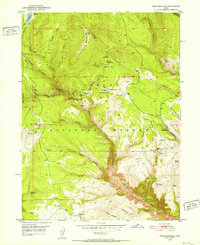
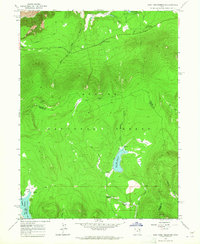
1950 Map of Dyer Mountain
USGS Topo · Published 1991About this map
Dyer Mines and several open pit mining operations define the high-altitude industrial character of this portion of the Ashley National Forest. Located near the summit of Dyer Mountain, these sites sit amidst a complex network of canyons and hollows, including Davis Hollow and Kane Hollow. Evidence of earlier activity is recorded at the Bullionville (Site), while the presence of the Military Reservation Boundary suggests the strategic importance of this high-country terrain.
Find a feature on this map
45 named features on this map. Tap any name to fly to it.
Don’t see what you’re looking for? This feature index may not catch every label — zoom into the map to look around manually.
Map Details
Editions of this 1950 Dyer Mountain Map
3 editions found
Other maps of this area

1885 · Ashley
USGS Topo · 1:250,000

1906 · Marsh Peak
USGS Topo · 1:125,000

1908 · Marsh Peak
USGS Topo · 1:125,000
1950 · Burnt Cabin Gorge
USGS Topo · 1:24,000
1950 · Dyer Mountain
USGS Topo · 1:24,000

1954 · Vernal
USGS Topo · 1:250,000

1958 · Vernal
USGS Topo · 1:250,000

1960 · Vernal
USGS Topo · 1:250,000
1963 · East Park Reservoir
USGS Topo · 1:24,000
1963 · Elk Park
USGS Topo · 1:24,000